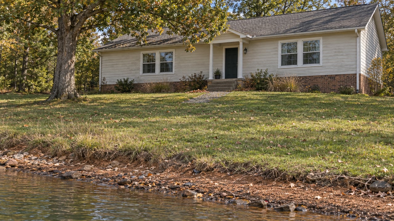
In July, WHSV reported that Ray Talley, deputy chief of Smith Mountain Lake Fire and Rescue, said: "There are pieces of land now that are out of the water that people didn't see before." Crews had pulled four people off a boat that had run aground on one of those newly exposed patches; the boat was still sitting on land days later. Talley's crews have spent much of this year finding hazards that used to be safely underwater, and the reason has less to do with bad luck than with a number written into a federal license decades ago.
Most explanations for this year's low water stop at "drought," and that's true as far as it goes. But the lake didn't drop because Appalachian Power decided to draw it down for profit, and it didn't drop by accident either. It dropped because the Smith Mountain Project's FERC license requires the utility to keep releasing a minimum amount of water downstream no matter how little rain falls into the watershed, and 2026 delivered the driest stretch of inflow the project has logged in years. Once you see that mechanism, the rest of this fall's headlines at the lake, the boating hazards, the marina slowdown, even the surprisingly good water quality report, line up as symptoms of the same equation rather than as separate stories.
The Math Behind the Drop
Smith Mountain Lake's normal full pond elevation is 795 feet, with a typical operating band between 793 and 795 feet. Through the summer and into September, the lake has been running four to six feet below that mark, a deficit that's shown up consistently from a mid-July reading of roughly 789 feet to a mid-September report of nearly six feet below pond level.
The driver isn't a mystery once you look at what fed the lake and what the license required it to release. Inflow to the Smith Mountain Project fell from about 1,311 cubic feet per second in February to roughly 397 cfs in June and 330 cfs in July, a decline of close to 75 percent in five months. The project's license sets an absolute minimum downstream release of 400 cfs. By July, the water coming in was already below what the license obligates the utility to send out. That's not a policy choice APCo can adjust around; it's math. When inflow drops below the mandated release, the lake has to give up the difference, and it did.
USDA declared 24 Virginia counties, including Franklin County, as drought disaster areas on April 15. The project itself logged two internal drought triggers that spring, one on April 27 and a second on May 11, formal checkpoints in a drought management plan built for exactly this scenario. Appalachian Power publishes its own readings on its water levels and flows page, and the August 22 report shows the same squeeze: inflow of 330 cfs against 412 cfs discharged from Leesville, with the lake at 790.3 feet. That is a supply problem colliding with a fixed legal requirement, not a discretionary drawdown.
| Normal full pond | Typical operating range | Fall 2026 | |
|---|---|---|---|
| Smith Mountain Lake elevation | 795 ft | 793–795 ft | roughly 789–790 ft |
| Project inflow | varies seasonally | — | 330–397 cfs (June–July) |
| License minimum release | — | 400 cfs | inflow fell below this in July |
What That Actually Changes on the Water
For anyone who keeps a boat here, the mechanism explains a pattern crews have been describing all summer. Todd Ohlerich, chief of Smith Mountain Lake Marine Fire and Rescue, said the total number of emergency calls hasn't shifted much from a typical year, but the kind of calls has. Boats running aground have replaced boat-to-boat collisions as the more common incident, something he said isn't usual for a typical summer. Part of the problem is that most onboard GPS units and electronic chart plotters aren't adjusted for this year's water level, so boaters trust a screen that's showing them a lake that no longer exists at that depth. At night, the risk compounds: staring at a lit screen kills night vision, and by the time a boater looks up, their eyes need time to adjust to the dark water and the new shoals sitting in it.
Crews have also responded to more medical calls involving people stepping off docks and floating platforms, expecting the water to be a few feet down rather than the five or six feet it's actually dropped. That rescue illustrates the same problem from a different angle: land that wasn't visible for years is now sitting in the middle of routine boating channels, and it's catching people who are navigating from memory instead of from what's actually there.
The Business Side of a Fixed Number
The businesses that depend on boat traffic have felt the same equation from the revenue side. Bridgewater Marina reported that foot traffic fell along with the water levels heading into Labor Day, with fewer people spending time on the water and some visitors changing plans altogether. Kevin Gray, owner of Smith Mountain Lake Coffeehouse, said his shop was running about 20 percent down from the past few summers, though he credited local regulars and vacationing visitors for keeping the season from being worse.
Not every operator is framing it as a crisis. Roy Enslow, manager at Goodhue Boat Company, put it plainly: the lake is still usable, as long as people use precautions and stay aware of their surroundings. That's the practical version of the same mechanism at work. The minimum release requirement doesn't care whether it's Labor Day weekend or a slow Tuesday in October. It holds steady regardless of tourism revenue, which is exactly why the drop has felt so uniform across marinas, restaurants, and guide services this year rather than hitting one pocket of the lake harder than another.
The Part That Isn't Actually Bad News
A lower lake sounds like it should mean worse water, but this year's monitoring data doesn't support that assumption. The Smith Mountain Lake Association just wrapped up the 40th year of its Water Quality Monitoring Program, with 52 volunteers sampling more than 80 locations across the lake despite the low water making some boat lifts inaccessible. Water clarity came in at 2.03 meters, essentially in line with the 20-year average of 2.08 meters. Phosphorus, the nutrient that fuels algae growth, averaged 27.9 parts per billion, a slight improvement over the 20-year average of 28.2. Chlorophyll, which tracks algal growth directly, came in a bit above average at 9.1 parts per billion against a 7.5 baseline, but SMLA's Tom Hardy attributed that to the warm summer itself rather than to the low water, and noted the increase was concentrated in specific spots like Craddock Creek and the area near the dam rather than spread across the lake.
That local read lines up with a broader study released this month by Virginia Tech's Water Resources Research Center, working with the Virginia Department of Environmental Quality, the Virginia Department of Health, and SMLA. The team pulled together water quality records dating back to the 1990s, satellite imagery, land-use data, and watershed modeling to build a clearer picture of what actually drives harmful algal blooms here. Lead investigator Daniel McLaughlin described the risk factors as a specific combination: sun, warm days, calm water, and elevated nutrients. The data didn't show blooms as a recurring problem at Smith Mountain Lake, though McLaughlin was clear that warming water and shoreline development are trends worth watching going forward. SMLA Lake Quality Council chair Keri Green said the study gives the community its first real overall picture of watershed conditions, something residents didn't have before. The findings, along with a new SML Webtool for tracking future data, were presented at the SML Annual Meeting at Resurrection Church in Moneta.
What Bringing the Lake Back Actually Requires
Talley offered the clearest sense of scale for what recovery looks like. Reaching full pond again would take an estimated 14 inches of rain, and even a single inch of lake rise requires roughly 530 million gallons of water. Getting that much rain in one stretch is unlikely, which is why the same license mechanism that explains the drop also explains why it won't reverse quickly.
There's a seasonal wrinkle worth watching, though. Appalachian Power's Izzy Post-Ruhland tied much of this summer's heavier generation directly to hot weather driving electricity demand for air conditioning. As temperatures ease into fall, that demand curve should ease with it, which means less pressure on the turbines even without a major rain event. It won't refill the lake on its own, but it's the first variable in this equation that's likely to move in the right direction as the season turns.
If you're weighing what this year's water levels mean for a dock, a boat slip, or a property you're watching along the shoreline, Alexandra Taylor is glad to talk through the specifics with you.
This article is general information, not legal, tax or financial advice. Consult a qualified professional about your situation.